Your cart is currently empty!
Category: saltwater
-
Day 18–Cars, Ferries, Vans, and Kayaks
Miles MPG Avg. Speed Today 176 50.6 46 Trip 5279 47 48 Food
(today/budget)Hotel
(today/budget)Trip Savings
$25 / $104 $70 / $100 AAA – $26
PriceLine – $915
Real $$ – $280Kayaking $204 Ferry $24 Note: Crossposted from my roadtrip blog.
Up at 6:00, then an hour drive to the ferry, and an hour ferry ride to Friday Harbor on San Juan Island. Next time, I think I’ll just stay in Seattle and take the seaplane to the island.
I like the island’s attitude … a taxi with racks.
We met the van from the outfitter, Outdoor Odysseys, and took a twenty minute ride across the island to the put-in on the west coast.
A popular put-in at the state park on that side of the island and some of the major outfitters have racks of boats there full time.
We launched into some crystal clear (and cold) water, then rafted up with the guide and two other boats in the kelp bed. Then we left the launch cove and started south down the coast.
The flood-tide was running from south to north, so we had to hug the shore to stay out of the current. This was hard for me to keep in mind, because a a rocky, lee shore with which I’m not familiar is a thing to give some distance.
But staying near shore gave us the opportunity to check out some things exposed by the low tide that had just ended.
The far shore, eight miles away, is Canada and the Olympia mountain range, after crossing the 900-foot deep channel.
After a couple hours, we arrived at the beach for lunch. Outdoor Odysseys is one of the few operators that provide lunch – most others tell you to bring a sandwich.
Fresh fruit, peanut butter and jelly, tomatoes, cucumbers and two kinds of hummus made up the lunch, all or mostly-all organic and local – pretty good, as well.
At the lunch beach, a seal came by. One of three we saw and the only one I was able to get a picture of.
Also no picture of the ugly naked guy swimming and sunning himself. He was frolicking in the water near the rocky headland and when he got out of the water, I said to myself, “That’s an odd looking bathing sui … nope, that’s his ass.”
Then he proceeded to flop down on the rocks and sun himself.
Back on the water we proceeded south some more, still hugging the shore and Aryn got a great underwater shot of two seastars.
For the return trip, we headed out from shore to pick up the still-flooding current. The trip out there was pretty fun, with the current and back-eddies generating a lot of waves in unpredictable patterns. I’d rate it a fast Class-II.
With the current, we hit 9 mph on the way back, according to the GPS.
Then it was back in the van for the ride to Friday Harbor and the ferry. We had time to eat again before the ferry left at 6:30.
-
Saint Joseph Sound Spoil Islands
December in Florida. On the water at 11:30, clear blue skies and 72-degrees.
This was a trip to visit the spoil islands in Saint Joseph Sound to pick one for camping in a few weeks. Spoil islands are the result of dredging channels – the material dredged from the bottom of the channel is loaded on a barge and the barge is periodically dumped to the side of the channel.
This results in evenly spaced islands (or bars if there wasn’t enough material) along the line of the channel. In this case there are six islands about a half mile apart running north of the Dunedin-Honeymoon Island causeway. The channel continues to the north, but the islands stop – the northern dump sites didn’t rise to the level of islands.
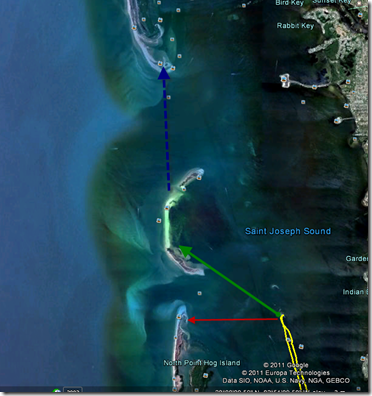
(open in Google Earth)
(7 miles – 3:30)There’s a lot of rock and oyster shell around the causeway and islands, much of it exposed at low tide, which is when I arrived to put in. The oyster shell will tear up a boat faster even than rock, so don’t drag your boat over it. Also watch your step, as it’ll slice your feet up just as easily.
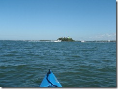
I set course for the first island in the chain and started off. Getting there from where I put in on the causeway meant crossing the boat channel. I always laugh at kayakers who start talking about marine law and right-of-way regarding powered boats. In my book, right-of-way goes to who won’t wind up as flotsam and chum after the collision, so I always make sure the channels are clear for a long ways before trying to cross.
This is not clear enough:
The reason we wait until it’s completely clear, of course, is because no matter how well the day’s going, no matter how swift your stroke is … dead center of the channel will be the spot your cooler decides to slide off the back deck of the boat and become a sea anchor. Did this happen today? Of course it did. This is why I want a new boat.
On some of the islands, local conservation groups are busily at work replacing non-native vegetation. While I can agree with this in principal, I still think the Australian pines just look better than native growth.
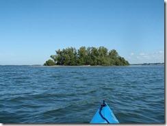
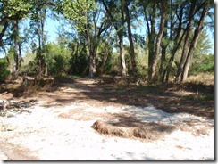
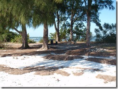
The first and second islands north of the causeway have rock fire pits and cleared areas suitable for camping. The second is larger and someone has brought in a picnic table.
Both were nicely free of trash, with only a few cans or bottles around. Most of these had already been placed in the fire pits.
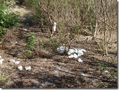
On the first island, though, there’s clearly a “bathroom” area that some people aren’t following “leave no trace” in.
If you can’t handle packing it out, then stay somewhere there’s a toilet.
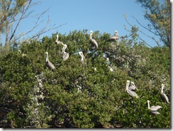
The third island north of the causeway is an Audubon sanctuary, so landing is not permitted. The fourth was inaccessible during my trip due to the tide – exposed rock and oyster shell made landing a bad idea.
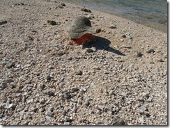
Island five had a little surprise in store for me. The low tide exposed a spit of sand and an odd looking rock that turned out to be this little guy:
Not every day that you see one of these on the beach.
The last island in the chain is small and rocky, with only a few scrub trees for cover.
Even so, if the weather forecast is good, it will probably be my choice for camping, because it’s isolated and well-positioned as a base. From here, it’s only two miles to either Honeymoon (red) or the bars north of Honeymoon (green), and from them it’s only another two miles to Anclote (blue).
-
Honeymoon Island
I had a bit of a later start than I planned this morning, due mostly to a muttered “oh, hell, no” and slap at the alarm clock around 0-dark-thirty.
Once up, though, I loaded the car and hit the road for Dunedin, FL, stopping just twice:
- Subway for breakfast and lunch – their new breakfast is pretty good, easily in the top five of semi-fast-food, after Panera, Starbucks and Chick-Fil-A, and the cheapest of the four. Quite a bit above McDonald’s or Burger King. Plus you can pick up a cooler-friendly lunch at the same time.
-
The Best Buy in Dunedin to pick up an iPhone battery. Yes, I know you can’t replace the battery in them. I was looking for either a solar charger or charger that uses regular batteries, because I’ve been using the iPhone as my GPS tracker on trips (safely ensconced in the deck bag, of course), but the GPS eats battery life. What I found was this thing from Energizer that works as an external rechargeable battery:
So far, so good – it ran the iPhone for GPS tracking over four hours today and the phone still had a full charge.
A good put-in to paddle either Honeymoon Island or nearby Caladesi is from the Dunedin Causeway.
View Dunedin Causeway in a larger mapView Dunedin Causeway Put In in a larger map
You can enter the state park on Honeymoon Island, but the portage from parking lot to beach is a lot longer than on the causeway:
Of course I still haven’t repaired the seat padding that blew off, so I had to improvise an
ass-padcushion.All in all a folded towel is okay, except for the part where it gets saturated and you sit around in salt-water all day … but the Tarpon’s a wet boat anyway, so I didn’t really notice.
My goal today was to circumnavigate Honeymoon Island then paddle around St. Joseph Sound on the east side of Caladesi. With the late start and the stops, I only managed the first half of that.
GPS tracking powered by InstaMapper.com
The weather forecast called for the winds to be out of the ESE between 8 and 12 MPH, so I started my trip on the east side of the island (going counterclockwise), putting the wind and waves at my back and quarter for the first part of the trip.
I did have to paddle into the stronger wind for the latter part of the trip down the west side of the island, but it was a much shorter distance to face that than the east would have been. You can see from the GPS track that I was a lot slower on the West side, especially when I got far enough south to be out of the lee of the island.
I passed near Grassy Key on my way north, a small mangrove island.
Most of the southeast portion of Honeymoon is mangrove also, with no beaches or stopping places.
It’s not until you round the northernmost headland of mangroves that the shore begins to offer places to beach.
I stopped three times on the east side of the island.
The first stop was because I had to pee. I know, TMI, but under the Florida sun: If you don’t have to pee, you’re not drinking enough. Something Florida paddlers should keep in mind. I also picked up about a dozen cans and bottles at this stop to dispose of properly.
The second stop was because I thought I remembered there being an easy portage spot there – clearly I was mistaken, since that stop was at about the widest part of that portion of the island. So much for my memory.
And the third stop was because an osprey had perched on very low post.
The wind and waves were driving me right to the beach at the base of this short dune, so I was able to keep still and exit the boat out of his site. This let me get a lot closer for a picture.
The north end of Honeymoon is roped off and signed as restricted to protect nesting birds. The sandbar there is also a gathering spot for the feathered ones.
Rounding the north end of the island presents you with a view of the open Gulf.
The ocean-side of Honeymoon should be considered an open-water paddle. Unlike the sheltered sound to the east, the west-side can get the full force of wind, waves and currents. A basic understanding of currents and tides is helpful and you should be comfortable having nothing on one side of you until Mexico.
The combination today was a light wind out of the south and a moderate swell out of the south. Since I had to go south, this made the second half of today’s paddle more challenging. But I find swells easier to handle than the chop the wind was kicking up on the east side, so I’m glad I went counterclockwise today.
The northern beaches on Honeymoon are the farthest from the parking lots, so they’re not very crowded.
But this changes as you head south.
I saw only one dolphin on this trip, that just as I was turning east around the south end of the island. I wasn’t able to get a picture, because he only surfaced twice, both times quickly and heading north.
I pulled onto the beach at the very southern tip of the island, just before the channel and crossing to Caladesi, where I had a quick lunch. As soon as I had my sandwich in hand, this guy showed up to try mooching a bite.
His presence also irritated a couple other gulls who were busy with the preliminaries to seagull sex.
After lunch, I crossed the channel to the Caladesi side.
But I decided to call it a day and head for the causeway and home.
-
A Quick Trip at Haulover
I had some time this afternoon and decided to run over to Haulover Canal for a quick paddle.
GPS tracking powered by InstaMapper.com
I started from the large landing area at the west end of the canal.
Took the canal east under the bridge and out into open water for a short way.
The water’s eroded small sea-caves in the bank, visible at low tide.
There appeared to be a single manatee at the observation platform, but it was very close to shore, so no good pictures. But once onto open water, you have to ask yourself: Is there a better place to be on a Florida afternoon?
Outside the shelter of the canal, the wind was just a little east of south, so had a full six-mile fetch to work up the waves.
So after about a mile of paddling straight into the wind, I turned around and headed back to the canal. Is it a bad sign when the buzzards start circling your boat?
Back in the canal, still no good manatee pictures, but I did find a dolphin enjoying himself.
And churning up quite a wake from under the surface.
And managed to get a little bit of video of him:
Since I had to be home by eight, it was time to pull the boat out and head back. At an hour one way to get there from my house, I spent more time in the car than on the water … it’s a fair trade.
